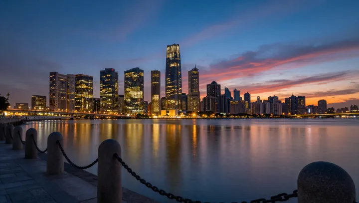
Sunset does quality control that zoning maps never manage. As the sun drops behind the city, a routine industrial pier on Boston harbor starts to behave like an unplanned photometer, translating stray light from office towers into a precise drawing on the water. The concrete stays dull. The harbor does the work. Its surface, flattened by evening wind decay and governed by surface tension, becomes a conditional mirror whose accuracy depends on how still the water is and how low the sun sits under the glass line.
What looks like a postcard view is actually a physics audit. Glass curtain walls, designed for daylight and HVAC efficiency, suddenly act as arrays of planar mirrors; each pane obeys Snell’s law and the Fresnel equations, bouncing narrow bands of sunlight toward the pier. Where towers align with the solar angle, their reflected beams converge on the harbor, carving bright vertical streaks that mark the true massing of the skyline, not the brochure outline. Gaps in development show up as dark lanes. Shorter brick buildings, with rougher, less specular façades, simply fall out of the optical record.
The quiet surprise is that the pier itself becomes an instrument without a single sensor chip. Its railings, bollards and mooring lines register the moving light bands as the sun angle shifts, turning the whole structure into a fixed baseline for an impromptu lidar made only of geometry and water. On rare evenings when the harbor is almost perfectly laminar and glass facades are still lit from within, Boston’s actual vertical profile appears as a flickering but remarkably faithful graph, written in reflection, read only by those who bother to stand there and watch.